Texas 1-d-1 wildlife management valuation
Keep your ag valuation.
Manage for wildlife.
AcreSteward turns a guided set of questions about your land into a complete wildlife-management conversion package — the plan, the official forms, and map exhibits built from your parcel records or a boundary you draw or upload — ready for you to review, sign, and file with your appraisal district yourself.
Open now and free during the public beta. No credit card required. Pricing details
Self-preparation software — you stay in control of every page you file.
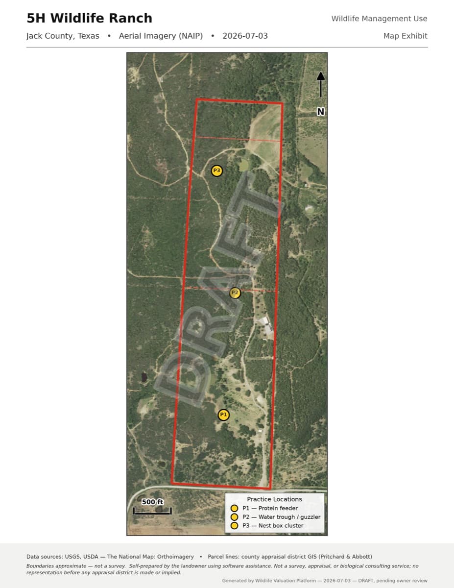
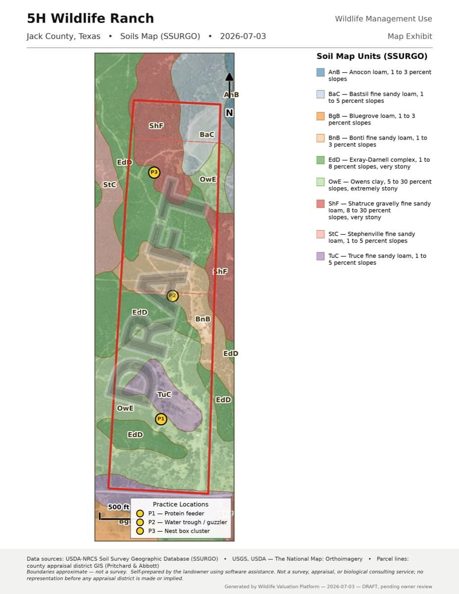
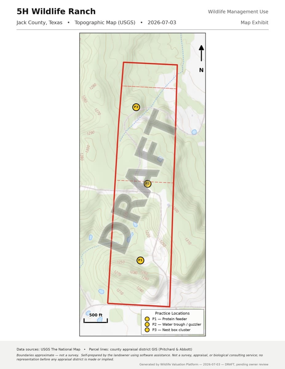
Real map exhibits generated for the founder’s own ranch in Jack County, Texas — not mockups.
How it works
- 1
Answer questions about your land
A guided, plain-English walkthrough: your county, your acreage, your target species, and the wildlife management practices that fit your part of Texas. We explain the official form names as you go.
- 2
Get your complete DRAFT package
The wildlife management plan, the official TPWD and Comptroller forms filled from your answers, map exhibits of your property (boundary from county or state parcel records, or a file you upload), and a filing checklist — every page stamped DRAFT until you review it.
- 3
Review, sign, and file it yourself
You check every document, confirm it, and file with your county appraisal district. Nothing is filed for you, and the decision always rests with the chief appraiser.
What you get: seven documents, one package
Everything a wildlife-management conversion filing needs, generated from your answers and stamped DRAFT until you’ve reviewed each page.
Wildlife management plan
A structured plan document built from your answers: goals, habitat, target species, and your selected practices with the amount of work planned each year.
State wildlife plan form (PWD-885)
TPWD's own wildlife management plan form, filled from your plan — the same file your appraisal district expects.
Agricultural appraisal application (50-129)
The 1-d-1 open-space application with the wildlife management section completed — one per county for multi-county tracts.
Filing checklist
What to sign, where to send it, and the dates that matter for your county.
Aerial map exhibit
Public aerial photos with your property boundary and practice locations marked; imagery dates vary by location.
Soils map exhibit
The kinds of soil on your property, using the federal soil survey.
Topographic map exhibit
Elevation contours and terrain around your property, with your boundary overlaid.
- Multi-county tract? You get a 50-129 for each county’s appraisal district automatically.
The three map exhibits are built from your property boundary — pulled automatically from county or state parcel records, drawn by you on an aerial map, or uploaded as a boundary file; you can also generate the package without maps.
Honest pricing
Open now and free during the public beta. No credit card required. The prices below are planned prices for the paid launch, not charges today.
Conversion package
$399 one-time
- Plan, forms and checklist, plus three maps when a boundary is available and map generation succeeds
- Review flow: DRAFT stamps come off only after you confirm
- Your documents stored in your account, exportable any time
Annual season
$199 /year
- Season task list built from your plan’s practices
- Field activity logging with photos and GPS, offline-friendly
- Annual report (PWD-888) drafted from your year’s logs
No payment is taken today. We will publish the paid launch date and confirm pricing before asking you to buy. The annual subscription is planned and is not sold here yet.
Straight answers
- When can I file?
- The regular filing window is January 1 through April 30 of the tax year. Before the deadline, the chief appraiser may grant up to a 60-day extension for good cause on a written request. After April 30, late applications are generally accepted until the appraisal review board approves the appraisal records for the year, with a 10% penalty. The filing checklist in your package walks through the dates for your situation.
- Do I qualify?
- Your land must already have 1-d-1 open-space agricultural (or timber) valuation, and wildlife management must become its primary use. A qualifying plan uses at least three of the seven statutory practice categories — we recommend five — at the intensity levels TPWD publishes for your ecoregion. The wizard checks all of this as you go and tells you honestly if something doesn’t fit.
- Is this a consultant or biologist service?
- No. This is software for preparing your own filing. It does not provide legal, tax, or biological consulting advice, and no one here reviews your documents, represents you, or contacts your appraisal district. Some practice guidelines call for professional involvement, including certain predator-control plans. Check the requirements for your selected activities and seek qualified help where needed.
- Why is everything stamped DRAFT?
- Because you haven’t reviewed it yet. Every generated document carries a DRAFT stamp until you go through the review step and confirm each one — then the final, stamp-free versions are produced for you to sign and file.
For self-preparation only
This software helps you prepare your own wildlife management plan and application documents. It is not legal, tax, or biological consulting advice, it is not a substitute for the advice of an attorney or other qualified professional, and using it does not create any professional relationship. Every document is a draft for your review: you are responsible for verifying it, signing it, and filing it with your appraisal district yourself — this software never files anything or communicates with an appraisal district on your behalf. Whether an application is granted is decided solely by the chief appraiser, and no particular outcome is promised or implied. If your situation is complex, consider having a qualified professional review your filing.
Narrative sections are machine-drafted from your own answers — read and verify them before you attest. Full ground rules: Terms of Service · Privacy Policy.
Learn the rules
Four short guides to the parts of Texas wildlife-management valuation that people most often get wrong.
- The real Texas wildlife exemption filing window
When to file, the 60-day good-cause extension, and what a late filing costs.
- The 3-of-7 rule: which wildlife management practices Texas requires
The seven statutory practices, why we recommend five, and the annual intensity standards most people miss.
- You bought ag-exempt land in Texas — now what?
The valuation doesn’t transfer with the deed — the re-application every new owner owes by April 30.
- A real PWD-885 example: our own 150 acres
A complete conversion package for the founder’s own 150 acres in Jack County — real maps and downloadable example forms.
Get product and filing-season updates
Applications for a tax year are filed January 1 – April 30. Leave your email for product updates and filing-season news. You can start your plan now without joining this list.
Optional. We use this address for AcreSteward product and filing-season updates.