A real PWD-885 example: our own 150 acres
Educational information about Texas property-tax law — not legal or tax advice. The standing disclaimer in the footer applies.
Open a sample document before you start
Preview or download the plan, state forms and checklist below. This downloadable set uses fictional property details; the map examples later on this page come from the founder’s Jack County ranch.
These are real files generated by AcreSteward on September 11, 2026 for a fictional 150-acre Jack County property. Names are examples; address, account numbers and unanswered form choices are left blank. They are stamped DRAFT and are not for filing.
The counts describe blank form boxes and lines, including optional details and unanswered choices. They do not mean that every blank is a required answer. PDF previews of Word files may paginate differently in your Word app.
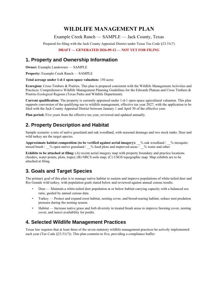
Wildlife management plan
Your goals, habitat and selected practices. Download the Word file to read every section.
No tracked blanks — review every page
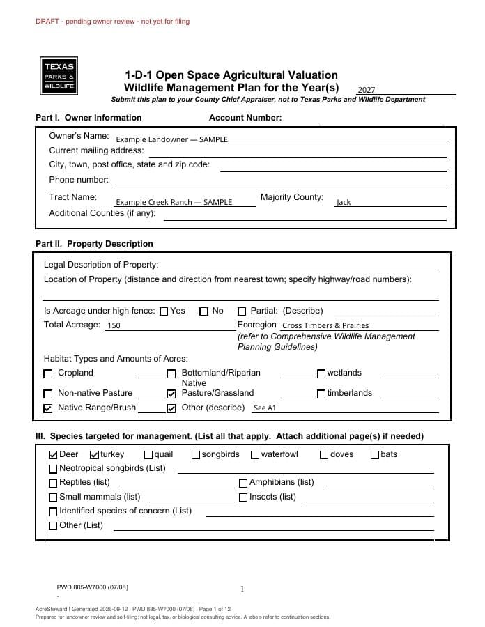
State wildlife plan form (PWD-885)
Download the editable PDF to complete choices and details. Longer answers appear on labeled continuation pages; check every page before signing.
172 blank form fields to review · 217 don't apply to your plan (left blank, exactly as on the paper form)
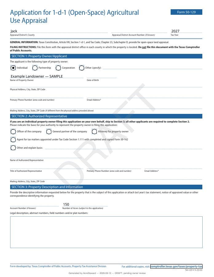
Agricultural appraisal application (50-129)
The application you file with each county appraisal district. Download the PDF to complete its editable fields.
81 blank form fields to review
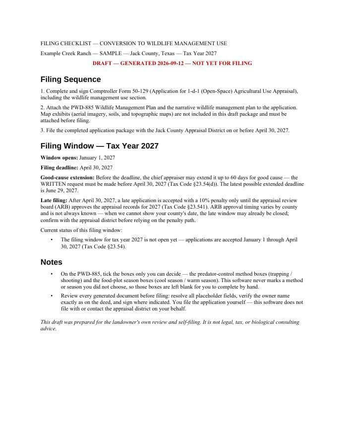
Filing checklist
What to review, sign and include, plus the filing dates for this package.
No tracked blanks — review every page
What a complete package contains
A wildlife-management conversion filing isn’t one form — it’s a package. A complete one holds:
- The narrative wildlife management plan: goals, habitat description, target species, and the practices with their intensity commitments.
- The official TPWD PWD-885 form, filled from that plan.
- Comptroller Form 50-129 with the wildlife management section completed — one per county for a multi-county tract.
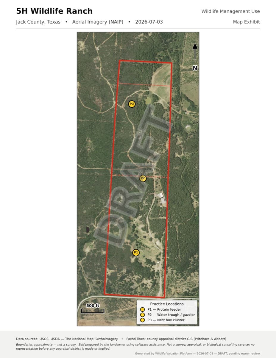
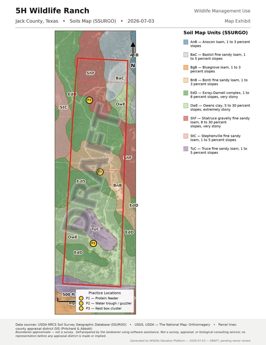
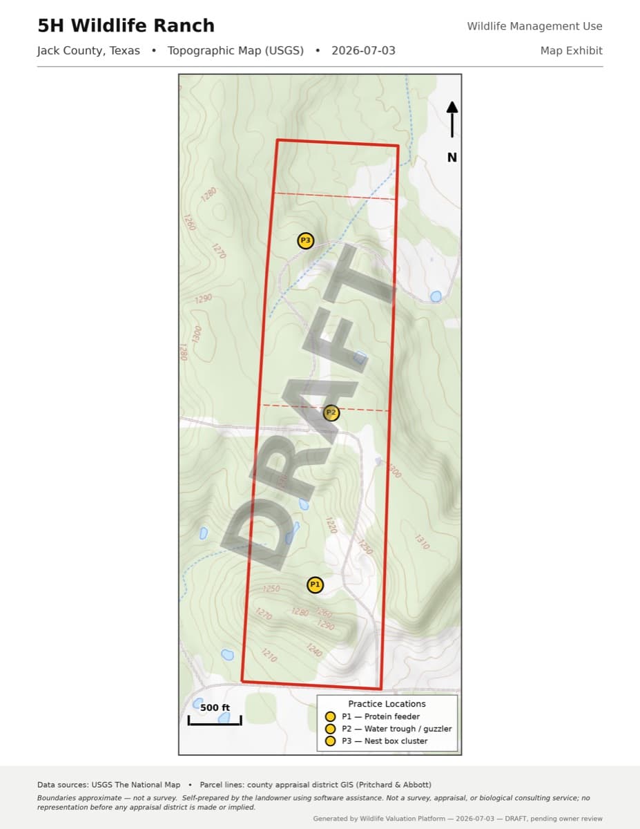
- Three map exhibits — aerial imagery, soils, and topography — each with the property boundary, when a boundary is on file.
- A filing checklist with the dates and the district address.
Fictional documents and real map illustrations
The downloadable sample documents use a fictional 150-acre Jack County property and example names. They are draft examples, not the founder’s filing package.
The map illustrations below show the founder’s own ranch in Jack County. They demonstrate the map output separately from the fictional document examples.
We check sample outputs when the document generator changes. Always review your own answers and documents before filing.
The three map exhibits
With a property boundary, the app can prepare three maps from public data — aerial photos, soil survey information and terrain contours — with your boundary overlaid. The boundary comes from county or state parcel records, a boundary you draw, or a file you upload. These are the actual exhibits from the Jack County package:
What the plan’s sections actually say
The goals section states, in plain sentences, what the management is for: the target species and the population and habitat outcomes the owner is working toward.
The habitat description covers what the land actually is — soils, cover types, water — grounded in the same data the map exhibits draw from.
The practices table lists each selected practice with its annual intensity commitment, matched to TPWD’s Cross Timbers standards, so a reviewer can see at a glance what will be done and how much of it each year.
The exhibits close the package: the boundary and practice locations on aerial imagery, the soil units, and the topography.
What we deliberately don’t claim
No outcome promises. The decision on every application belongs to the chief appraiser — no software and no consultant can promise what a district will decide.
You review, sign, and file everything yourself — nothing is filed for you.
Documents stay stamped DRAFT until you attest that you’ve reviewed them; only then are the final versions produced for you to sign and file.
Turn the rules into a filing
AcreSteward turns a guided set of questions about your land into a complete DRAFT conversion package — the wildlife management plan, the official PWD-885 and 50-129 forms, map exhibits of your property (from parcel records, or a boundary you draw or upload), and a filing checklist — ready for you to review, sign, and file with your appraisal district yourself.
Start your plan — free todayYou can use AcreSteward today. Want product and filing-season news? Get email updates